The Lost City of Thamanin?
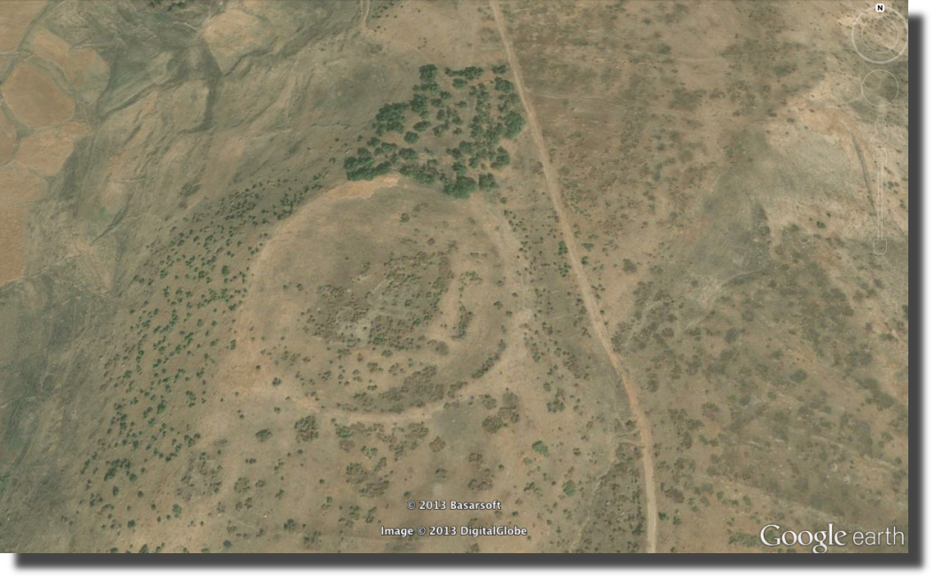
I noticed this strangely perfect circle in the satellite photos of a very remote area that has been sealed off for decades due to conflict:
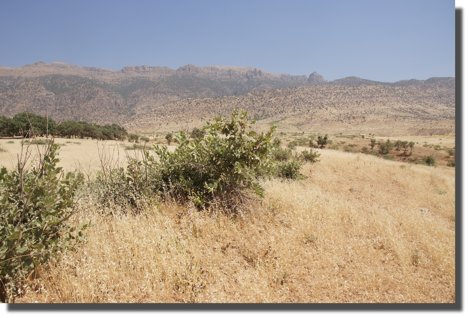
 When I first arrived at the coordinates, this was all I found:
 Most of the perimeter that appears circular from space is just a mounded edge encased with earth and vegetation:
 However, on the northeast corner I found a place where the mounding is missing and instead a structure of stone is exposed:
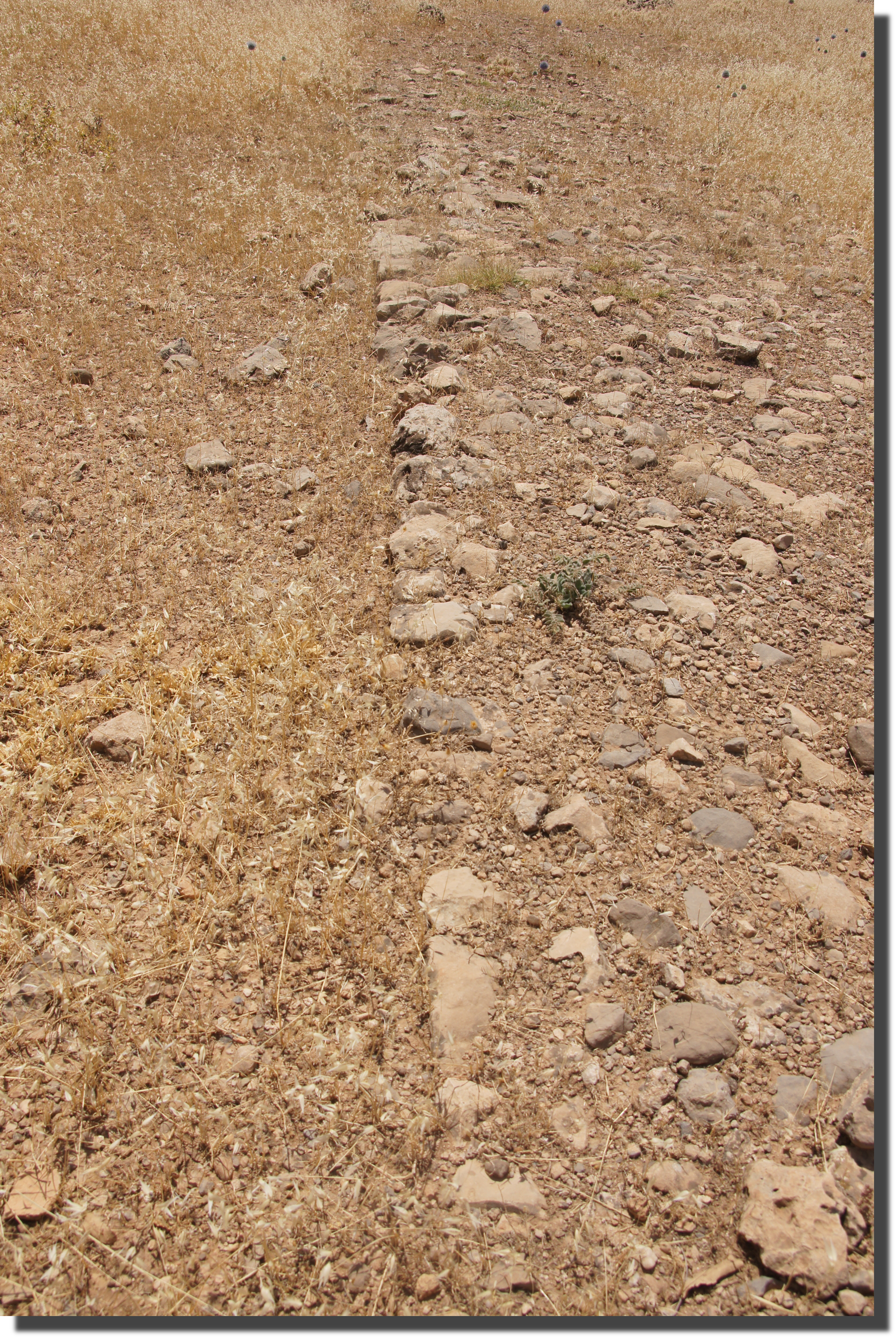 This appears to be the remains of a circular wall more than 600 feet in diameter.The edge or facade of the wall appears to have been formed of regular stonework, while its interior appears to have been filled more haphazardly. Semicircular protrusions occur at regular intervals around the perimeter, perhaps the remains of guard towers:
 I believe this is the town that the Arabic geographers called Thamanin and believed to be the oldest city in the world. It was said to have lain just at the southern foot of Mount Cudi. It also occurs in early Christian documents, such as The Book of the Cave of Treasures from circa 350 AD. And the Byzantine Emperor Heraclius stayed here circa 628 AD when he visited Mt. Cudi to see Noah’s ark. This Suq Thamanin seems to have been the staging site for such pilgrimages as well as a place of interest in its own right.
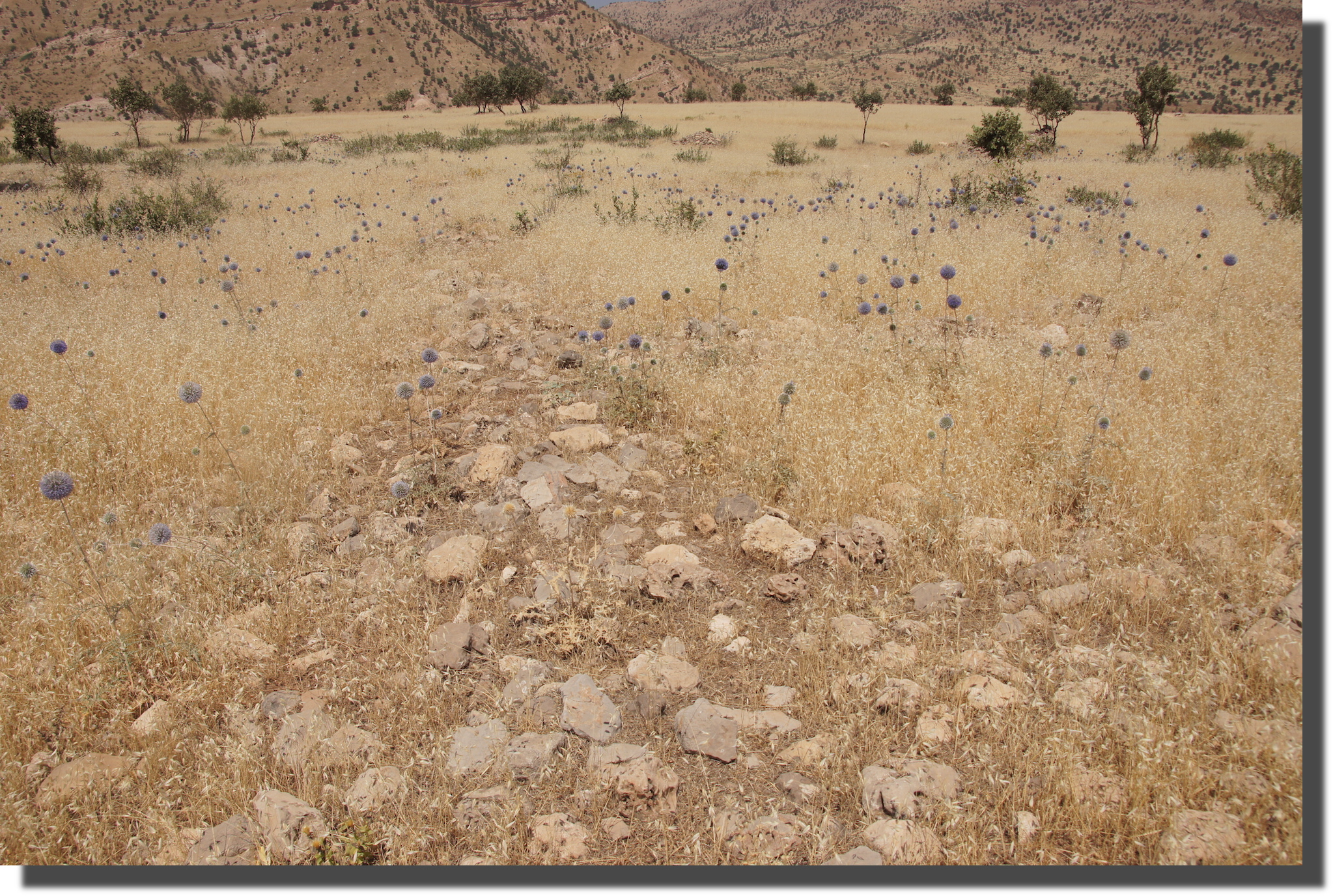
Whatever its origins, it fell into ruins nearly a millennia ago. In the 10th century, Al-Muqaddasi described Thamanin as a fair-sized city on the edge of a stream one day’s march to the west of Cizre. But by the 13th century Hamdallah Mustawfi found it in ruins “at the foot of Mt. Judi.” And the city ruins that I found had likewise clearly been in ruins for a very long time. Here is a view of the apparently collapsed wall as viewed from outside the circle looking in:
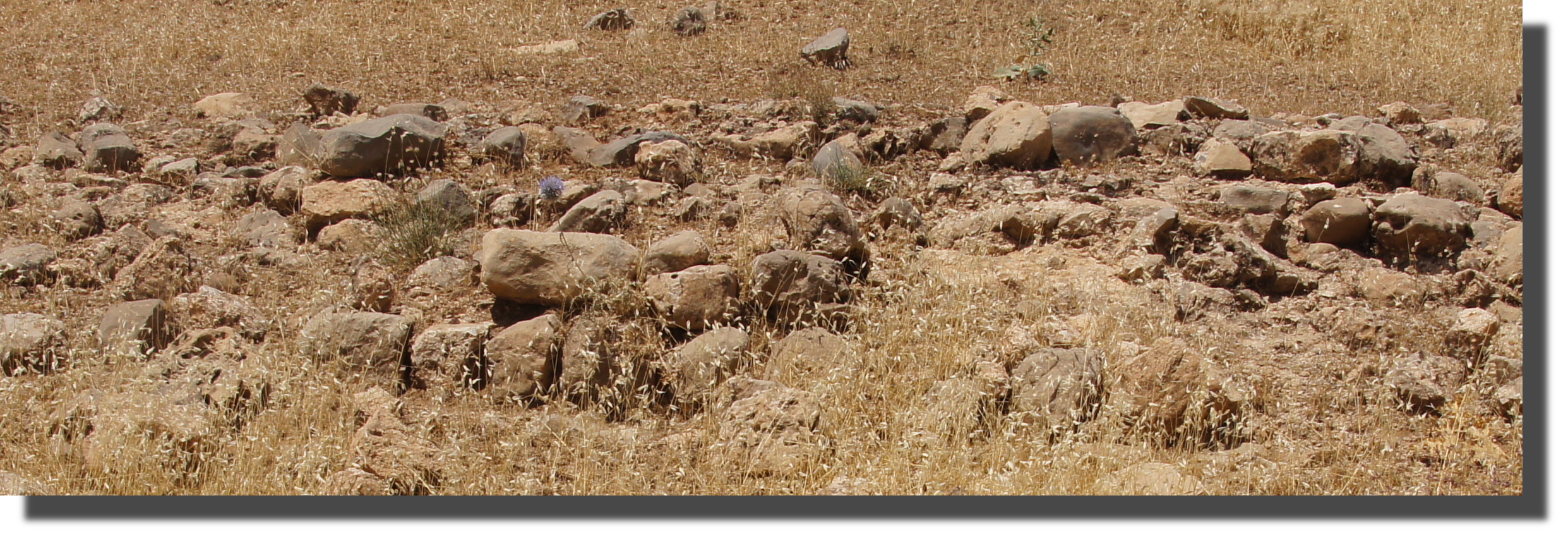 Notice on the satellite photo above that there is a grid-like pattern inside the circle. These also appear to be the remains of stone walls, with the foundations of other stone walls branching off at right-angles:

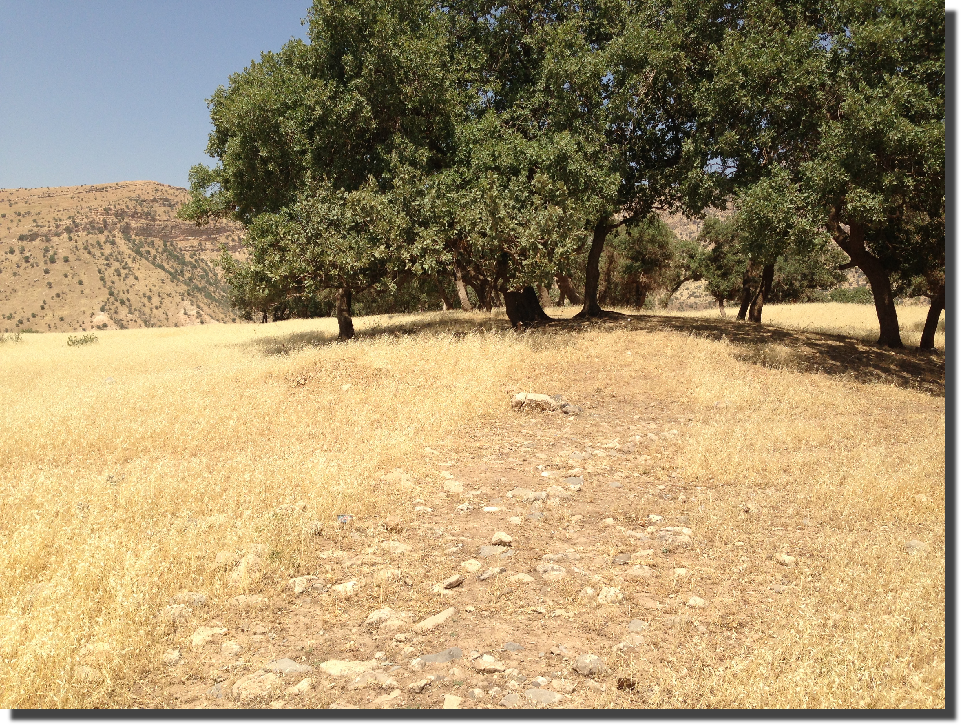
 The grove of trees here covers additional mounding in the shape of a rectangle in front of the northeast end of the circular city walls. See the satellite photo above. This entrance to or extension of the city walls points at the summit of Mt. Cudi:
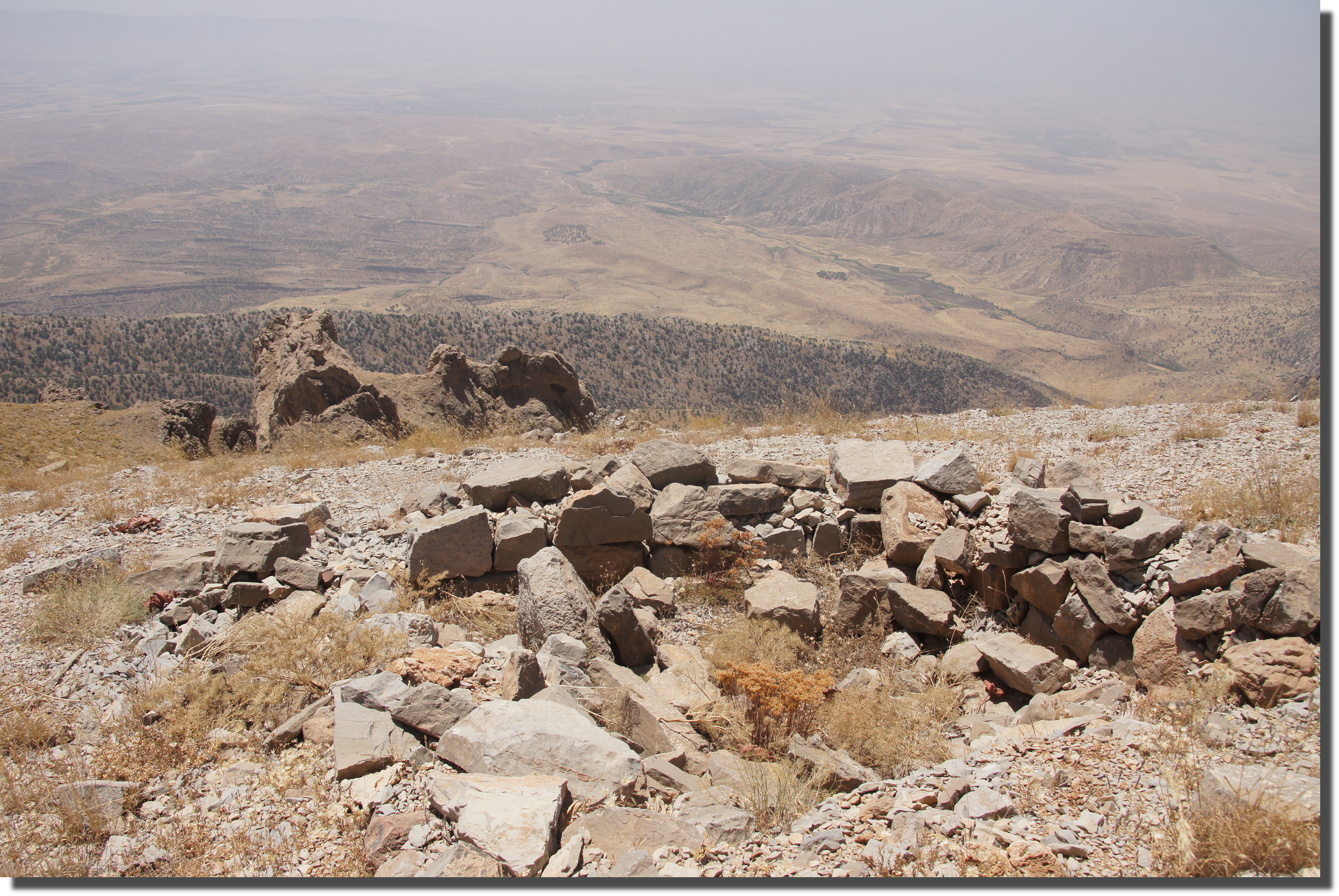
 This is from atop Mt. Cudi. The city’s faint, lighter-colored circle and square grove of trees can be seen (to the right of center and just to left of the stream) pointing up toward the summit:
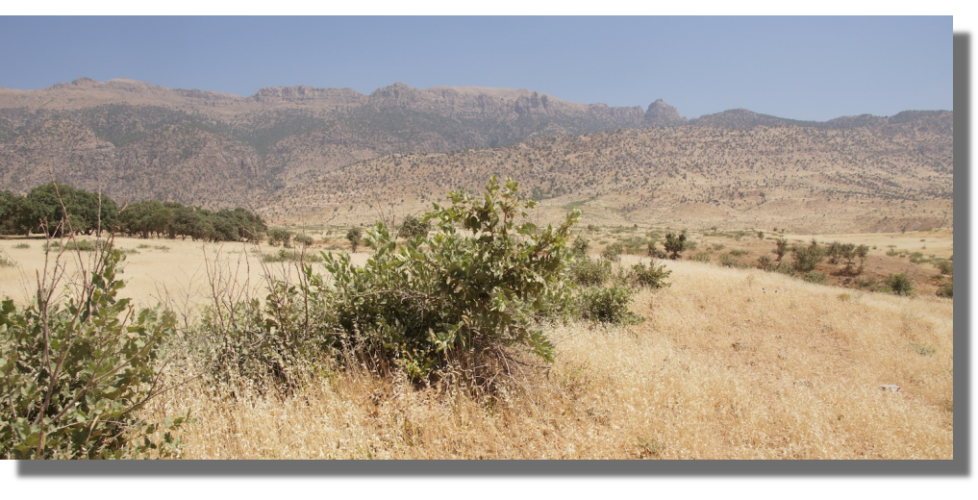
 The use of Thamanin as the layover spot for pilgrims seeking to visit Mt. Cudi, going back to at least the time of the Heraclius, is consistent with the location and orientation of this archaeological site. There is also a unique artifact from atop the mountain that depicts the sacred summit and the circular Thamanin below, but I will save that for the book.
Here are the coordinates for those who want to explore the satellite imagery for themselves: 37 19′ 45″ N 42 28′ 7″ E. You can see some other interesting structures around the old city wall. The area around the mountain is also peppered with the remains of tiny villages that did not survive the conflicts of the twentieth century. But this city wall was planned and organized at a much larger scale than the more recent village homes of goat herders and subsistence farmers. Although, I suspect some more recently ruined stone huts nearby were built of ready-made stone blocks appropriated from the ruins of Thamanin.
 When I first arrived at the coordinates, this was all I found:
 Most of the perimeter that appears circular from space is just a mounded edge encased with earth and vegetation:
 However, on the northeast corner I found a place where the mounding is missing and instead a structure of stone is exposed:
 This appears to be the remains of a circular wall more than 600 feet in diameter.The edge or facade of the wall appears to have been formed of regular stonework, while its interior appears to have been filled more haphazardly. Semicircular protrusions occur at regular intervals around the perimeter, perhaps the remains of guard towers:
 I believe this is the town that the Arabic geographers called Thamanin and believed to be the oldest city in the world. It was said to have lain just at the southern foot of Mount Cudi. It also occurs in early Christian documents, such as The Book of the Cave of Treasures from circa 350 AD. And the Byzantine Emperor Heraclius stayed here circa 628 AD when he visited Mt. Cudi to see Noah’s ark. This Suq Thamanin seems to have been the staging site for such pilgrimages as well as a place of interest in its own right.
Whatever its origins, it fell into ruins nearly a millennia ago. In the 10th century, Al-Muqaddasi described Thamanin as a fair-sized city on the edge of a stream one day’s march to the west of Cizre. But by the 13th century Hamdallah Mustawfi found it in ruins “at the foot of Mt. Judi.” And the city ruins that I found had likewise clearly been in ruins for a very long time. Here is a view of the apparently collapsed wall as viewed from outside the circle looking in:
 Notice on the satellite photo above that there is a grid-like pattern inside the circle. These also appear to be the remains of stone walls, with the foundations of other stone walls branching off at right-angles:

 The grove of trees here covers additional mounding in the shape of a rectangle in front of the northeast end of the circular city walls. See the satellite photo above. This entrance to or extension of the city walls points at the summit of Mt. Cudi:
 This is from atop Mt. Cudi. The city’s faint, lighter-colored circle and square grove of trees can be seen (to the right of center and just to left of the stream) pointing up toward the summit:
 The use of Thamanin as the layover spot for pilgrims seeking to visit Mt. Cudi, going back to at least the time of the Heraclius, is consistent with the location and orientation of this archaeological site. There is also a unique artifact from atop the mountain that depicts the sacred summit and the circular Thamanin below, but I will save that for the book.
Here are the coordinates for those who want to explore the satellite imagery for themselves: 37 19′ 45″ N 42 28′ 7″ E. You can see some other interesting structures around the old city wall. The area around the mountain is also peppered with the remains of tiny villages that did not survive the conflicts of the twentieth century. But this city wall was planned and organized at a much larger scale than the more recent village homes of goat herders and subsistence farmers. Although, I suspect some more recently ruined stone huts nearby were built of ready-made stone blocks appropriated from the ruins of Thamanin.
May 11, 2014 @ 2:17 am
Fascinating! It’s hard to conceptualize Thamanin as it must have existed a millennia ago. Still, I can’t help imagining what life must have been like then, compared to the ruins now.
May 19, 2014 @ 3:21 am
Wow this is so interesting — I love that you saw the satellite image and decided to hunt it down. And you took some great photos. I agree with Annie; I love thinking about the history of a place…seems like there’s a lot here.
June 4, 2014 @ 9:13 pm
I would love to stand inside that circle and try and draw on embers of left over energy. My favourite thing to do on sites like this are to sit down and imagine what those people would have looked like, behaved like, lived like. They probably lived there life as you suggest through trading with pilgrims of Mount Cudi.
I find all ruins thoroughly fascinating because of all the information that isn’t shown. I find myself thinking “There is nothing there, no water!”. Then I remember that if there is foliage, there is water.
If there is more in your book, I can’t wait to find out what that is. I am very intrigued after reading this blog entry.
June 12, 2014 @ 10:15 pm
There are so many unknown places in the world that it really makes you wonder if you know anything about human existence… Take Thamanin for example, the oldest city in the world and you discovered it only now. How many hidden gems are deep inside the forest, under mountain rocks or simply right under our feet?
June 13, 2014 @ 12:24 am
I was always fascinated by things like this: travelling around the world, discovering lost cities, encapsulating as much as I can about the history of the place and the people that are creating a new history there now. This place is bewitching to the trained eye and the history behind it makes it even more magical. Thanks for posting this.
November 11, 2014 @ 1:12 am
I remember reading that Thamanin was said to have been founded by Noah after the arc came to rest on Mount Judi. In Islamic teachings, it is believed that Noah’s tomb is in Thamanin. What an incredible discovery!
May 25, 2021 @ 6:42 pm
Fascinating that you found the site settled by Noah and his descendants after the Flood. There is a reason it is called the oldest city in the world. From this place after many, many years the descendants of Noah went down to Shinar and eventually repopulated the entire world. His WORD is truth. Come to know its truth and salvation. May we all know the love and salvation of Yeshua, Son of our Father & Creator YeHoVaH. HalleluYah!!!